Once we got onto the Natchez Trace Parkway, it didn’t take us long to learn just what is a “sunken trace.” Our first hike was the Potkopinu section of the old Natchez Trail, part of an ancient (at least 10,000 years old) path connecting the Natchez, Choctaw, and Chickasaw nations. The path mostly follows an old ridge left from the retreat of the last ice age. This section cuts through a thick deposit of dust and dirt that settled on an old sea floor. The erosion of the finer dirt by endless travelers created these “sunken paths” that are in some places 20 or more feet below the surrounding terrain.

Hiking a “sunken” portion of the Trace 
Giant old beech tree hugging the steep embankment 
Vannie waits for us patiently at the trailhead


The Potkopinu section is only 3.6 miles long, but we had to hike it twice, in and out. It was fairly difficult, with a bit of up and down. The southern half was the best part, with amazing old-growth trees hanging onto the soil at the top of the embankments. Generally, the trail seemed to be seldom used and maintained even less. Nevertheless, it was a great day to be out. Not too hot, and we got to stretch our legs on some challenging terrain.
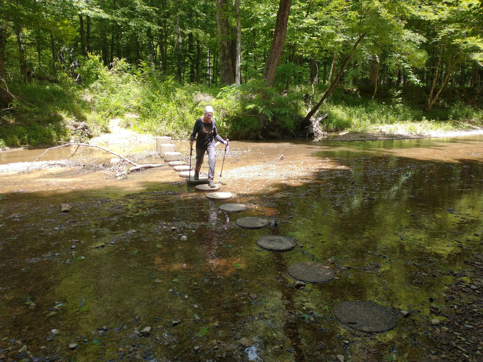
After hiking the Potkopinu section we drove to the Rocky Springs Campground, where there are more trails to hike on this 6-mile section that extended north and south of the campground. The campground, itself, was pretty dated and very rundown, with an abandoned entry station, boarded up bathrooms, and no potable water. But that didn’t overly concern us, as we were planning to hike this section in just one day. We started north on a bit of sunken trace. Then, in less than a mile, we struck out into dense forest on newer trail for the rest of our hike, following ridges and crossing ravines. The metal trail markers we were used seeing soon disappeared, replaced by hunters’ ribbon tied to tree branches. There were lots of blow-downs, no little trail maintenance, overgrowth obscuring the trail, and several times we had to stop to “re-find” our path. There were several stream crossings, two of which we had to wade.

The only stream that had pavers across kept our feet dry this time 
There’s a path here somewhere

After two hours, we passed the 4.2 mile point on our GPS tracking, where we expected to find the northern terminus for the Rocky Springs Section, according to the National Park Service website. Then 5 miles passed. I futzed with the Gaia app, but without service, it hadn’t downloaded a topo for this area. I finally tried Google Maps and luckily it did have the detail, and we discovered that we were still over a mile from our destination. Karen wasn’t happy, and neither was I. Discovering that the NPS info was so inaccurate really surprised us and changed how we now have to plan for the remainder of our Natchez hikes.
We finally got to the northern terminus of this section at Fisher Ferry Road at 6.1 miles. This in-and-out hike, that was supposed to be 8.4 miles, was now going to be 12.2 miles. The hike back was a little easier since we knew where most of the issues were, but that was little consolation and turned this section into a two-day effort.
The next day, we headed back to the campground trailhead to hike the southern part of the Rocky Spring Section. After some looking, Karen found the trail marker we headed in. It was fine for a short while, and then the trail just disappeared. We searched for another 15 minutes before giving up. We decided to drive to the southern terminus – 2.4 miles back down the Parkway – and try going north from there. We made it in about 1/4 mile and started to encounter numerous blow-downs and an unclear trail that seemed more like bushwhacking than hiking. It was pretty bad. Karen called it quits and we hiked back to the van.
I’m less averse to such conditions (or more stubborn), so I decided to try again on my own. I climbed over and around, too many blowdowns, waded through brambles that snagged my pants, lost the trail several times only to find it again with difficulty. However, I did chance upon a lost old cemetery surrounded by blow-downs. That was very cool. After less than a mile, the trail came out at a road crossing and I couldn’t find the re-entry point. I started road-walking in what I hoped was the right direction, hoping for a trail marker or ribbon. I never found one and end up walking the county road all the way back to the Rocky Springs campground.

A fallen tree knocked this newer footbridge off its moorings 
Forgotten collection of headstones deep in the forest 
Nice old survey marker, dating this part of the trail to 1958


Once there, and after a good rest, I tried again at the campground trailhead heading south. After losing the trail like we had before, I used my phone’s compass and GPS to get my bearings. I found my way to some Old Trace, then after that disappeared, a gully going my direction, then finally some blazes.
Less than a mile in, I come across some clear-cut roads, one grassy and one dirt. The grassy one had several deer blinds set up. I lost the trail again here and start walking down one of the roads. After a few hundred feet, I spotted an orange ribbon and ducked through the foliage to find what could be a trail. Lucky! I kept going and it cleared up. More blazes and even a couple of survey stones from 1958 positively marked this as the trail. Then next mile and a half were mostly clear and easy to follow, definitely the best part of this trail so far.
But then it disappeared again and I bushwacked a few hundred feet back to the county road I’d been on before, not far from where I’d first lost the trail when hiking north. I located that spot and waded through some brush and up a bank and located the trail again. The next .8 miles is just as bad a it was the first time. Even with my GPS, I made some wrong turns.
I finally made it back to the van, 3.8 miles and three and a half hours later, tired, dirty and sweaty. Karen was waiting with a bottle of icy water for me, and after cleaning up a bit, we head off to Jackson, MS, to resupply, and plan our next hike. We hope it will be better.
One thought on “Natchez Trace Parkway – Part 2”