by Rusty
The CT has long shared 234 miles of trail with the CDT in Colorado. But at Twin Lakes, the CT went east of the Sawatch Range and the Collegiate Peaks while the CDT went west, meeting up again south of Monarch Pass. It created a very appealing 160-mile loop for lots of hikers. After the Continental Divide Trail Alliance dissolved in early 2012, the Colorado Trail Foundation agreed to take over the Collegiate West Route, providing volunteer stewardship for this premiere alpine trail and add this scenic alternative for Colorado Trail thru-hikers. I’m glad they did.
The second half of my Collegiate Loop adventure would take me back south, along the Western Route and cross the Continental Divide several times. I would also travel elevations a thousand feet higher than anything on the Eastern Route, much of it above the tree line and through a truly alpine environment.
Day Five
It was clear and cold this morning, mid-30s I’m guessing because there was frost on the ground in the open areas. It took me a minute to get going because of the cold, but I still got on trail by 7:15am, my best effort this hike. I was surprised to see that the young “tramily” had broken camp already. It’s hard for 5 hikers to coordinate like that, especially on such a cold morning.
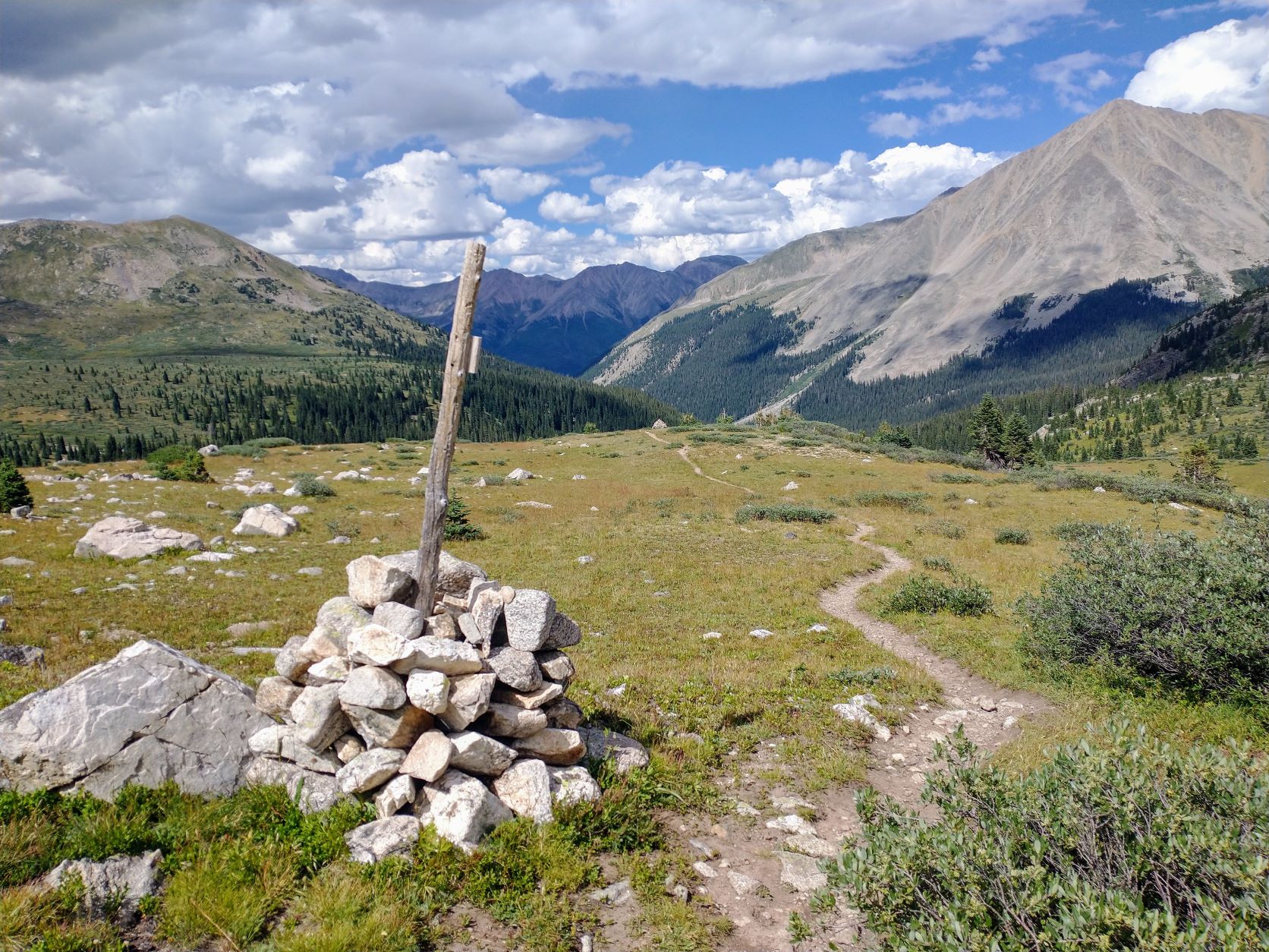
Because I stopped a little early the previous day, I still had more than two miles to the top of Hope Pass. The first mile was in the forest, steep and rocky and so cold. I didn’t expect such frigid mornings so I didn’t pack gloves. I had to stop frequently to blow warm air onto my hands just to keep them from going numb. The second mile opened up past the tree line and the warmth of the sun finally reached me. It was still slow going, but the trail seemed to get easier up here, with switchbacks through the alpine grasses, plants and flowers. At the top of Hope Pass (12,532 ft) was a shallow saddle below Mount Hope and a cairn adorned with flags. The views on both sides of the pass were impressive.


It was a steep 2.5 miles down the other side, again with switchbacks through alpine vegetation, then back into stunted pine, and finally through more mixed pine/aspen. At the bottom, the trail meandered gently uphill again for several miles through a wide, wet valley with Clear Creek running through it. Amazingly, after such a very cold start to the day, it was turning sunny and very warm and the trail was easy, greatly raising my spirits.
By 12:30 or so, I found a spot for lunch where I could spread out and dry some of my wet gear in the sun, especially my sleeping bag. I taped up my right big toe that was now starting to turn purple. It didn’t hurt too badly, except when I would inadvertently catch my foot on a rock or a root.
Back on the trail, I started climbing steeply up toward Lake Ann Pass, my second big ascent of the day. Hiking up one rocky section, I encounter a youth group on a day hike… and they had 2 pack llamas. I petted one of them, but I was so awestruck by the scene that I neglected to take a picture. Lol.


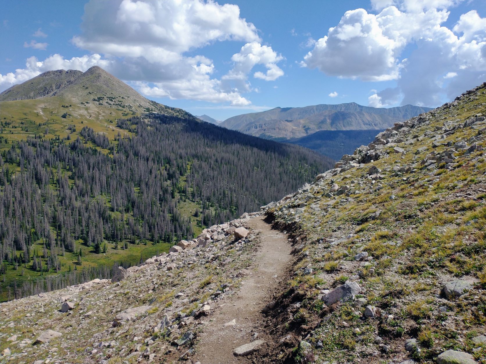
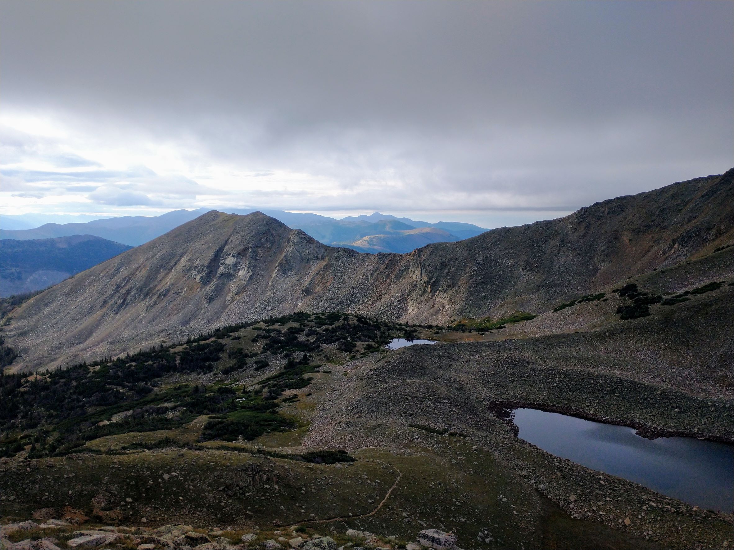
After an hour and a half of climbing, I came out of the trees and hiked past Lake Ann, a small but pretty mountain lake near the top of a massive ridge that was home to several 13ers, including the Three Apostles, Ice Mountain, and Grizzly Peak. The trail climbed through a huge talus field with some boulders as big as cars. At one point I missed a switchback in the rocks and had to scramble 100 ft back to the trail using my GPS. Then, the trail started up an even steeper climb to the pass, along very narrow switchbacks. Lots of pikas protested my passage. When finally I reached the pass at 12,650 ft, the wind was gusting. There was no cairn or sign to mark the pass, but there was another hiker already there admiring the views. We exchanged silent greetings, preserving the solitude of this moment, before continuing in our opposite directions.
Going down the other side was much less windy, with narrow switchbacks back down to the tree line a thousand feet below. I’d hoped to do 23 miles this day and get to Waterloo Gulch and Texas Creek, but the two big climbs today were harder and more time-consuming than I’d thought. The day was getting away from me, so I stopped just before 6pm when a tentsite with a nearby stream presented itself. I was 5 miles short of my goal for the day.
Then out of the blue (literally a blue sky) while I was setting up camp, a chill wind came up quickly, the sky darkened, and it started to rain. I rushed to get the rain fly on the tent and get everything inside. It only rained for an hour, but dang I was hoping for a dry night after such a beautiful sunny day. Oh well, it was monsoon season in Colorado.
Day Six
The day started out really cold again, so I pulled out some socks for my hands to keep them warm but it also made it hard to keep a good grip on my trekking poles as I climbed up the next ridge. On the other side, about halfway down to Texas Creek, I caught up with one of the “tramily” members. We talked mushrooms. A couple miles later we got to the Creek, which was where I’d hoped to end the previous day. The whole gang was there drying out their gear; apparently they’d set up camp in the rain the previous evening somewhere near my campsite. I didn’t stick around to talk much as it was going to be a long climb up to Cottonwood Pass and I had miles to make up.


Even though it was a 2,200 ft elevation gain to the pass, it was spread over 7 miles so it wasn’t too hard. The weather was clear again. And I was delighted with all the mushrooms popping up everywhere. Once I gained the pass, I was surprised to see a very busy scenic byway (CR 306/Cottonwood Pass Rd), a huge parking area at the top, and even a short summit trail for tourists to take pics. A few people asked about my hike as I walked through. I even met a couple of fellow vanlifers there who were going to do the Loop the following week.
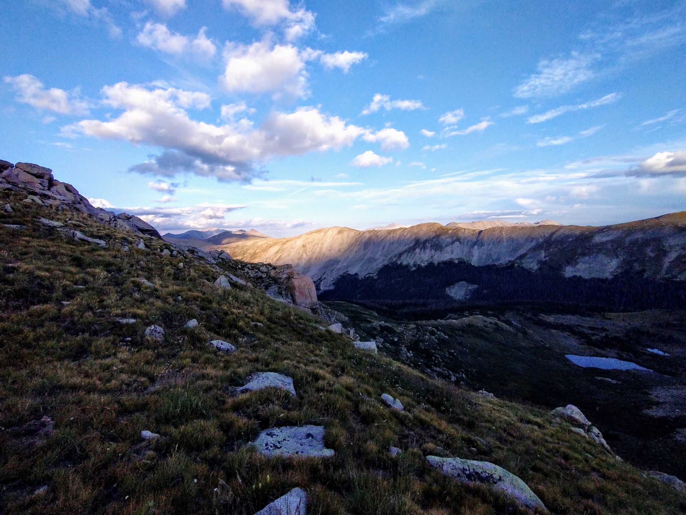
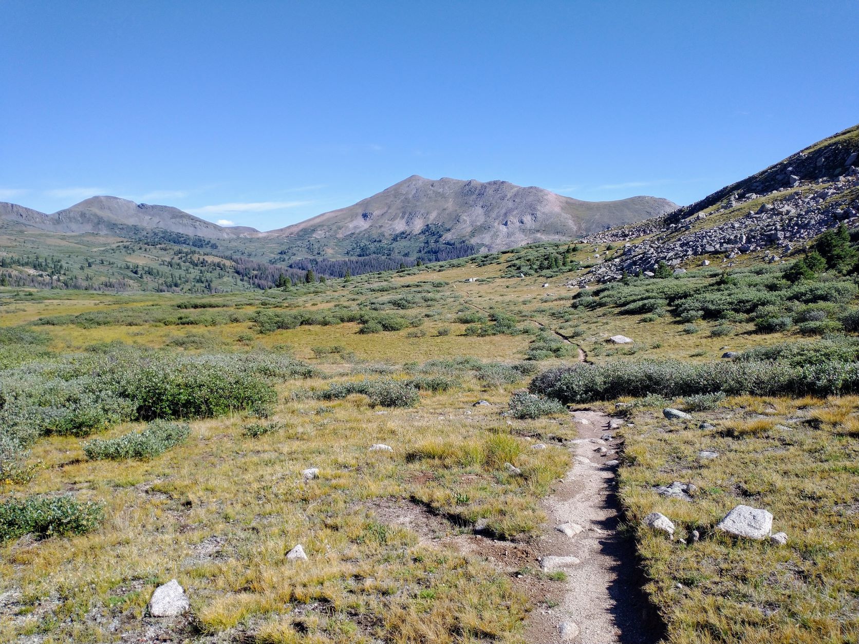
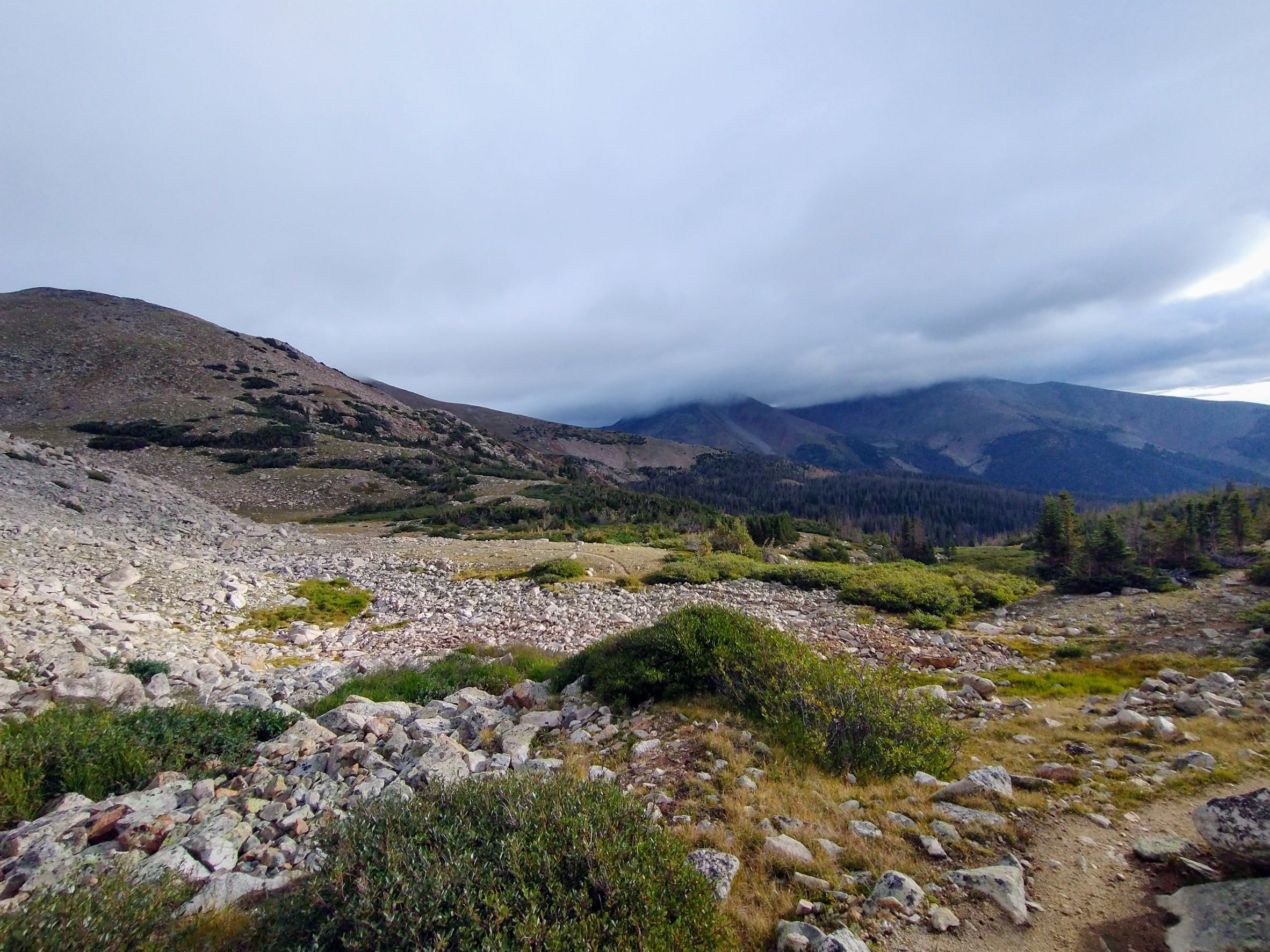
South of the pass, the trail transformed into what I had imagined would be alpine hiking on the Continental Divide. For the next twelve miles, I would be hiking between 12k and 13k ft, all above the tree line. The views were stunning, with dozens of peaks I couldn’t name stretching across the sky. Sometimes I felt like I was at the top of the world, able to reach out and touch the very limits of the sky above me. Each time I crossed a ridge, I’d encounter a new vista, with the trail stretching before me hugging the side of some steep slope. It was truly beautiful and I was totally alone.


There were several short climbs of 400-600 ft that would slow me down, of course. But the bulk of the day was fast going down after a climb or level along those open slopes in between. By 5:30pm, I’d hiked 20 miles and found myself at the bottom of a picturesque alpine valley near a stream. There were a few scattered but stunted pine trees, but mostly it was exposed with only a few shrubs to block the wind. Any chance of rain had passed. I could have tented there, but I decided to take a quick dinner and continue on and make up my lost miles.
There were two more big climbs to do before a big descent, tentsites and good water at North Fork Chalk Creek. The climbs were hard, with lots of talus fields to contend with. After so many hours on the trail, I was tired and winded and very, very slow going uphill, but I still felt strong on the flat or downhill parts. The last climb was the hardest, of course, about 600 ft up over a mountain ridge just as the sun was setting.


I put on head my lamp and started toward my final destination. It was about 8pm. I thought I’d soon be going downhill like usual. But instead I’d crossed over into a huge mountain bowl and had to go about halfway around before the trail would cross another ridge and descend back into the trees. It got very dark very quickly and the trail was just a narrow ledge around the bowl. At one point it was all bouldering and rocks through a long talus field. For the next hour all I focused on was the narrow trail that existed only in my spotlight, ignoring the steep drop-offs on my left that quickly disappeared into an inky blackness.
After what seemed an eternity, the trail left the bowl’s edge and onto more stable terrain. Then it dipped over a ridge and finally down into the forest. Then there were endless switchbacks and snagging branches, made spooky by the dancing shadows cast by my headlamp. I looked for glowing eyes in the night, but never saw another creature.
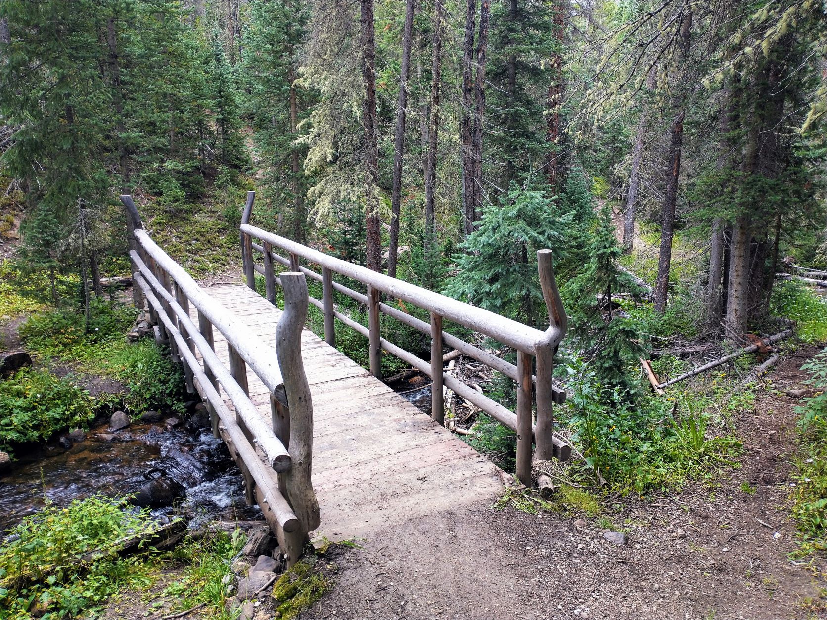
A couple more miles of this finally brought me to Chalk Creek. Finding a tentsite in the dark is hard, but after crossing a second creek and bridge, I spotted a tent and a hiker who was still awake and helped me navigate the surroundings. I hung a rope and my food bags, set up my tent and was soon fast asleep. I did 27.7 miles today, putting me at the 120-mile mark and back on schedule.
Day Seven
The day started out great, sunny and warm. I was planning on 3 major climbs, all mountain passes above 12k ft. The first couple of miles was, again, all switchbacks climbing back to the tree line. Then it was nothing but beautiful alpine hiking and amazing views. I saw more hikers here, and even a cyclist pushing her bike up a particularly steep section.
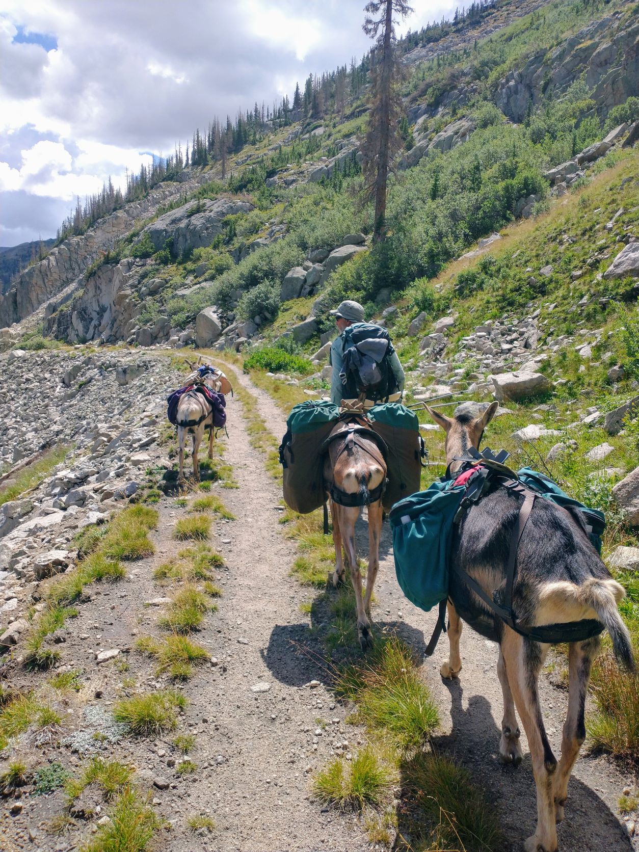
This climb topped out at about 12,400 ft at a Mount Helmers ridgeline and then the trail dipped down to about 11,500 ft to follow a portion of the former Denver, South Park and Pacific Railroad route from Denver to Gunnison. There was a tunnel constructed through the Continental Divide, the first ever, but it’s sealed up now. Along the old railbed, I met a couple, Tom and Cuyler, who were hiking with 4 pack goats, which was pretty cool.


After a short lunch, I was back on trail and started my next climb. It was about 12:30pm and still warm and sunny. Then about 1:30 I was halfway up the next climb, at about 11,800 ft and just coming out of the tree line, when a strong, cold wind came up. Clouds began to form overhead really quickly and BB-sized hail and rain started pelting me. I was right at the edge of an exposed talus field when the lightening started… really close. I backtracked to some small pines and took cover. I expected it to subside quickly like usual, but it didn’t. I pulled out the footprint for my tent and covered up. I sat there for an hour just huddled against the storm before it subsided enough for me to go on. I was cold and wet and shivering.
It was still drizzling, but the wind and hail and lightening had passed. And, I had to move on to make my planned campsite by dark. Still, it took me a mile of climbing through talus and up switchbacks to the next summit, Chalk Creek Pass, to finally warm up.


Coming down the other side, there was lots of water everywhere… under my feet, in the gullies, on the brush crowding the trail. My feet and legs were soaked. And it had apparently hailed even more on this side of the pass. As I neared the bottom of this descent, there were spots where I was slogging through 2-3 inches of hail, and it looked more like snow than anything.
The final climb of the day would take me up to a saddle just below Bald Mountain. There were supposed to be a couple of mountain lakes below that saddle with spots for tents. I hiked a couple miles up past Boss Lake Damn and Reservoir, then a little farther to Hunt Lake where I found several good campsites. I decided to stop there and was taking my time setting up camp (to hopefully let some things dry out a bit) when it started to drizzle again. It seemed like I’ll never dry out.
Day Eight
Twenty-three miles to go.
It was just too cold this morning to eat breakfast next to Hunt Lake at 11,500 ft, so I got on trail at 7:20am to do my first climb and look for some sun. It was a slow cold climb up past 12,500 ft to the Bald Mountain ridge, where the trail skirted around the south side of the mountain.
The weather got more overcast and windy, and misty clouds covered the mountaintop. I passed an interpretive sign where I was told that the ancient Utes built walls and ambush pits to corral and kill game here near Monarch Pass. But the visibility was too poor to see much.


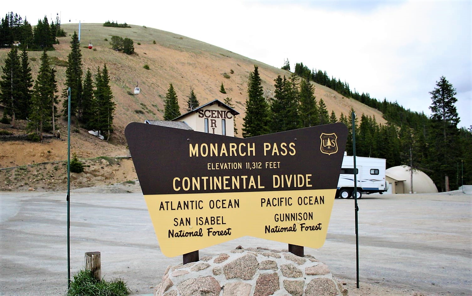
The trail gradually descended a ridge line until it passed through the Monarch Mountain Ski Resort. It followed wide and steep dirt roads that would be covered by deep snow in a few months. Nobody was around as I passed ski lifts and signs for black diamond ski runs.
I crossed a road at the old Monarch Pass and the trail dipped back into the forest for another mile or so before I came to Hwy 50 at the new Monarch Pass and a fancy gift shop. It was already about 11am and I’d just hiked over 8 miles. I was not making very good time, but I stop anyway to charge my phone at an outlet outside the gift shop to get water and finally eat my breakfast.
After half an hour, I took off up a multi-use dirt road, used by bicycles and motorcycles, next to the gondola lift. Half mile up, the trail left the dirt road, but there were lots and lots of fast bikers going by me forcing me to get off the trail periodically.
Eventually, I came back out of the tree line again as the trail wound around Mount Peck at about 12k ft. The weather turned cold and windy as I hiked back into the clouds. I met a young couple sheltering out of the wind. They were thru-hiking the CT northbound with an infant and the dad was changing its diaper. They were only at the halfway mark.


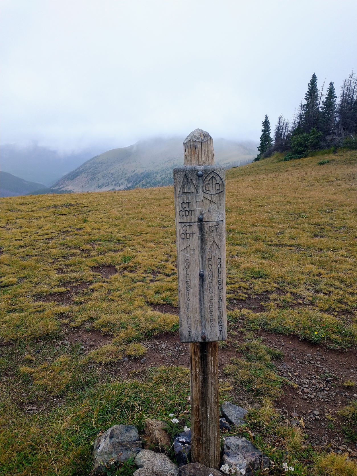


I continued on along the Continental Divide and finally reached the junction with the CT, nearly 14 miles into the day’s hike. The trail turned down a very steep and deeply eroded section back down into the trees. There were very few switchbacks here as I followed the ravine straight down about 6 miles as the South Fooses Creek took shape beside me. It turned rainy again and the trail got wet pretty fast as the soil was already very saturated. I had to hike around several wide, muddy pools, created by the thousands of bikers who’ve used and abused this trail over the years.
I finally came out at the South Fooses Creek Trailhead, and then another 3 miles of road walk before I came to the little parking area at Hwy 50 where I’d started 8 days before. Lea, my trail angel, was there waiting for me with a smile and a cold beer.
~ ~ ~
A short 25 minute drive and lots of trail talk later, and we were back at her house and our van. I got a much-needed hot shower and hot meal as a reward. Lea and Randy are great trail angels, and great new friends.
I succeeded in my goal of completing the160-mile Collegiate Loop in 8 days. But, I was definitely tired. My feet hurt. I reeked of sweat, salt and mildew from all the rain. This was a hard hike indeed and I was happy to be done.
Once I recover, Ren and I will ponder our next hike, a Rim-to-Rim hike of the Grand Canyon for me and maybe the Arizona Trail for both of us. But the Colorado Trail is now forever etched into me, and whenever we pass through here again I’ll be drawn inexorably to hike more of this world-class trail.