by Rusty
Ever since we started hiking segments of the Colorado Trail (CT) last year, I’ve had my eye on the Collegiate Loop, a 160.2-mile loop that encircles the vast Sawatch Range of the Rocky Mountains in Central Colorado. Several of the dozen or so 14ers here are named after Ivy League schools, including Yale, Oxford, Harvard, Columbia, and Princeton. This is the densest area of 14ers in the state and has the highest average elevation of any wilderness in the Lower 48. It sounded like it would be an extremely challenging hike.

At first, I thought I could combine the hike with summiting some or all of the 14k peaks, but each summit on its own would be a full day’s effort. This would turn an already hard 8-12 day loop hike into at a really gruesome 3-week expedition that would introduce significant gear and resupply issues. Not to mention that the current monsoon season was turning much wetter and longer than usual and wouldn’t help matters. In the end, I opted to do just the 160-mile hike and save the summits for later.
In addition, this would be my longest solo-hike since Ren and I met in 2017, and significant portions would be completely off-grid with no cellphone service. We decided to subscribe to one of the Satellite SOS and communication services that would allow me to check-in at the end of each day and enable Ren to follow my progress via hourly GPS tracking.
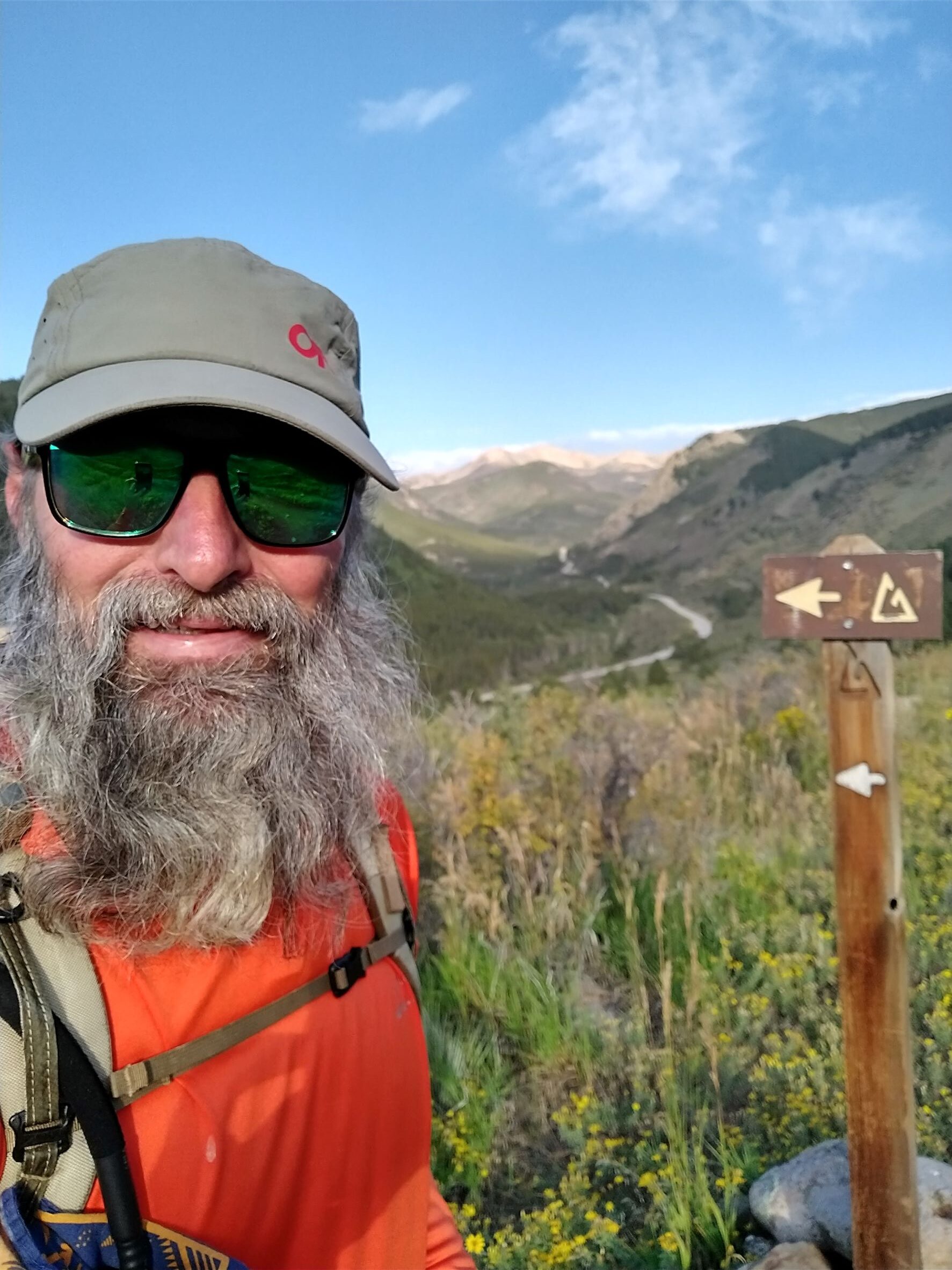
The loop is comprised of a 77-mile section of the CT on the east side of these peaks and an 83.2-mile section of the Continental Divide Trail (CDT) on the west side. I decided to start at the trailhead closest to southern end of the loop (Fooses Creek/Hwy 50), hike north on the Collegiate East Route, resupply at Twin Lakes at the northern end, and hike the Collegiate West Route back south. Our friends, Mary and Chris, introduced us to Lea and Randy, who live between Salida and Nathrop, CO. Lea agreed to be my trail angel and let me park our van at their place and shuttle me to the trailhead.
I gave myself 8 days for the hike, plus 2 days of travel and prep, hoping to average 20 miles per day, weather permitting. I packed enough food for 4+ days for the East Route. The weather forecasts predicted wet afternoons/evenings for the next few days, but clearing after that.
Day One
The next morning, I slept past my 5am alarm. But I was all packed and after a hasty breakfast, Lea and I were on the road for the 25-minute drive to the trailhead. Lea had hiked a good bit of the CT but not the Western Route, so there was lots of excited talk along the way about the upcoming hike and what I might encounter. Soon, we were at the Hwy 50 Trailhead and I was on my way at 7:42am, starting out at an elevation of 8,861 ft.
My day began with a modest nearly 1,000 ft climb over 4 miles through dense aspen and lodge pole pine forests. Within a couple miles I discovered that the water in my new bladder, which I’d filled 3 days before, tasted like plastic. Fortunately, the creeks were running full from the monsoon rains and I was able to replace it with freshly filtered mountain water that tasted wonderful.


I passed the summit trail for Mt Shavano and Mt Tabeguache, a beautiful mountain meadow surrounded by more aspen groves, and then briefly passed 10,200 ft before starting back down. I encountered lots of southbound (SOBO) thru-hikers, day-hikers and mountain-bikers along the way.
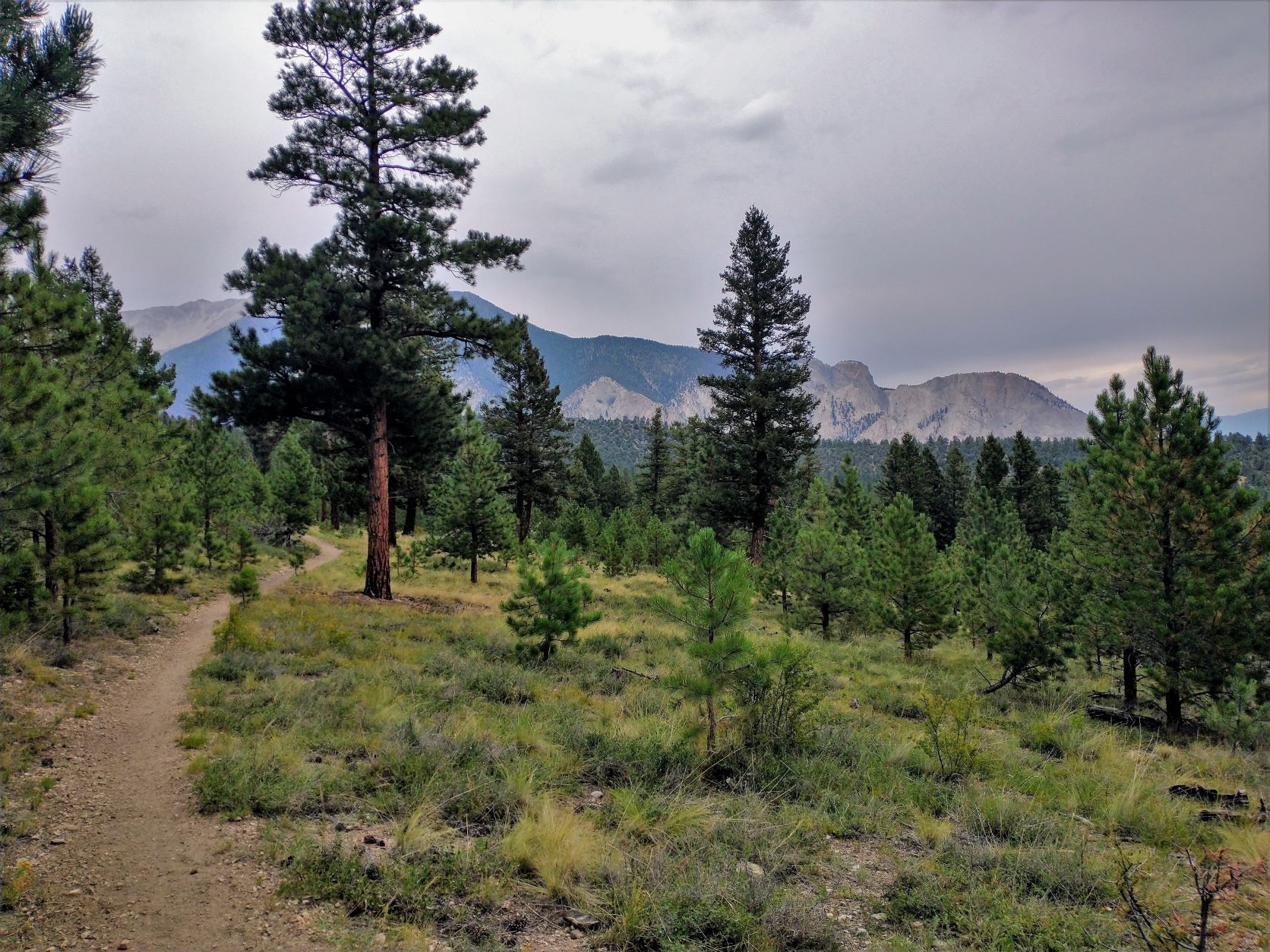
After lunch, the aspen began to give way to ponderosa pine. And even though I was descending back down below 9,000 ft, there were still occasional views of the surrounding mountains with Mt Princeton and the Chalk Cliffs to the north. By 2pm the clouds stated to move in and a few sprinkles prompted me to put on my pack cover and rain gear. One final climb over a ridge line and a steep descent brought me down to Bootleg Campground and Chalk Creek. I’d made 20.3 miles on my first day.
I made camp at this no-service, hike-in, tent-only campground at around 4:30pm just as the rain started in earnest. I didn’t bring a stove with me to save weight, opting instead for a cold-soaking method for my meals. Tonight’s dinner was cold ramen with dehydrate vegetables, tuna, and powdered coconut milk. It wasn’t nearly as good as the hot version and the clean-up was harder too.
It rained all evening and off-and-on all night. I brought our 7-year old Kelty Salida one-person tent (also trying to save weight) only to discover that the tape used to seal the seams on the rainfly were starting to delaminate and now were dripping down through the tent mesh, getting my down sleeping bag wet in spots. Not good.
Day Two
I woke up at about 6am. It was still raining and the cloud cover dimmed the rising sun. I hadn’t slept well, so I rolled over and went back to sleep, declining to deal with all the wetness and cold just yet. But an hour later, I woke again and the rain had stopped. I had a cold breakfast, no coffee, and packed up wet. I was on trail at 7:52am… late.
The first 6 miles was all roadwalk, my least favorite part of any hike. From Chalk Creek, two and a half miles of gentle downhill through a resort/retirement neighborhood brought me to the Mt Princeton Hot Springs Resort. Then it was uphill for 3.5 miles past Frontier Ranch, the 2-wheel drive trailhead for Mt Princeton, and then along a deeply rutted jeep road (FS Rd 322) before the trail dove back into the forest.


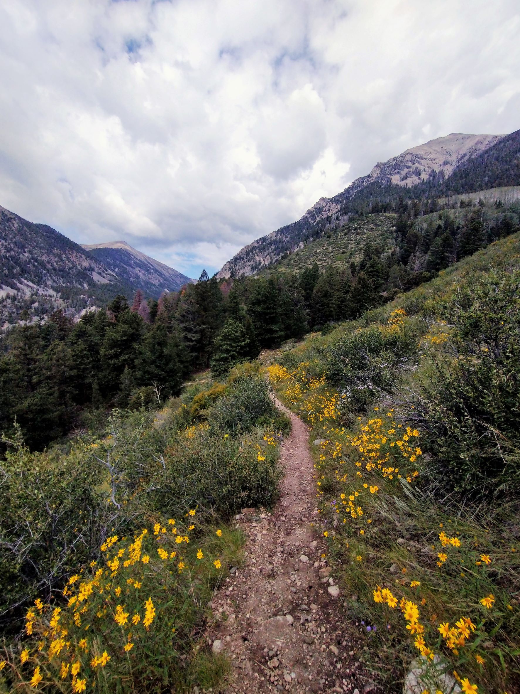
The next 5 miles hugged the slope of Mt Princeton below the tree line between 9,600 and 10,000 ft with lots of little ups and downs. I even caught a glimpse of Buena Vista once in the distant Arkansas River Valley. There were lots of bikers here, creeks running strong, and rocky sections where a hiker could stub his or her toes, which of course I did more than once. At the saddle just below Bald Mountain, the trail finally descended along a series of switchbacks down to 9,000 ft and South Cottonwood Creek. I hiked the Cottonwood Creek Trail to Middle Cottonwood Creek before crossing County Rd 306 and a long and steep climb up the other side. In just 3.5 miles, I would climb back up to 11,889 ft and the Mt Yale saddle and summit trail. This was by far the hardest part of the day. It was slow and simply exhausting, especially at the end of the day and nearly 19 miles in.
But I couldn’t camp there; there was no water. The descent on the north side was even steeper. I made better time descending but I was bone tired. I’d intended to go down 2.5 miles to the next trailhead at North Cottonwood Creek, but just one mile down I made it to Silver Creek and a decent tentsite at 11,100 ft. I ended the day at 19.8 miles (two miles short of my goal) and with a total elevation change of 6,919 ft.
Day Three
The day started out really cold, maybe 40 degrees, and my bag was still damp. It took me a little while to get going, but I was on trail just after 7:30am and the rest of the downhill to North Cottonwood Creek was nice enough. I was warm again by the time I got to the bottom.
After crossing the creek, I began a 10-mile climb (about 2,400 ft) past the Mt Harvard summit trail and then over a ridgeline at 11,845 ft. Stretching out climbs over long distances like this makes hikes much easier. There was some relatively flat hiking here and there throughout this section, and even a little downhill too, so I made good time through here.


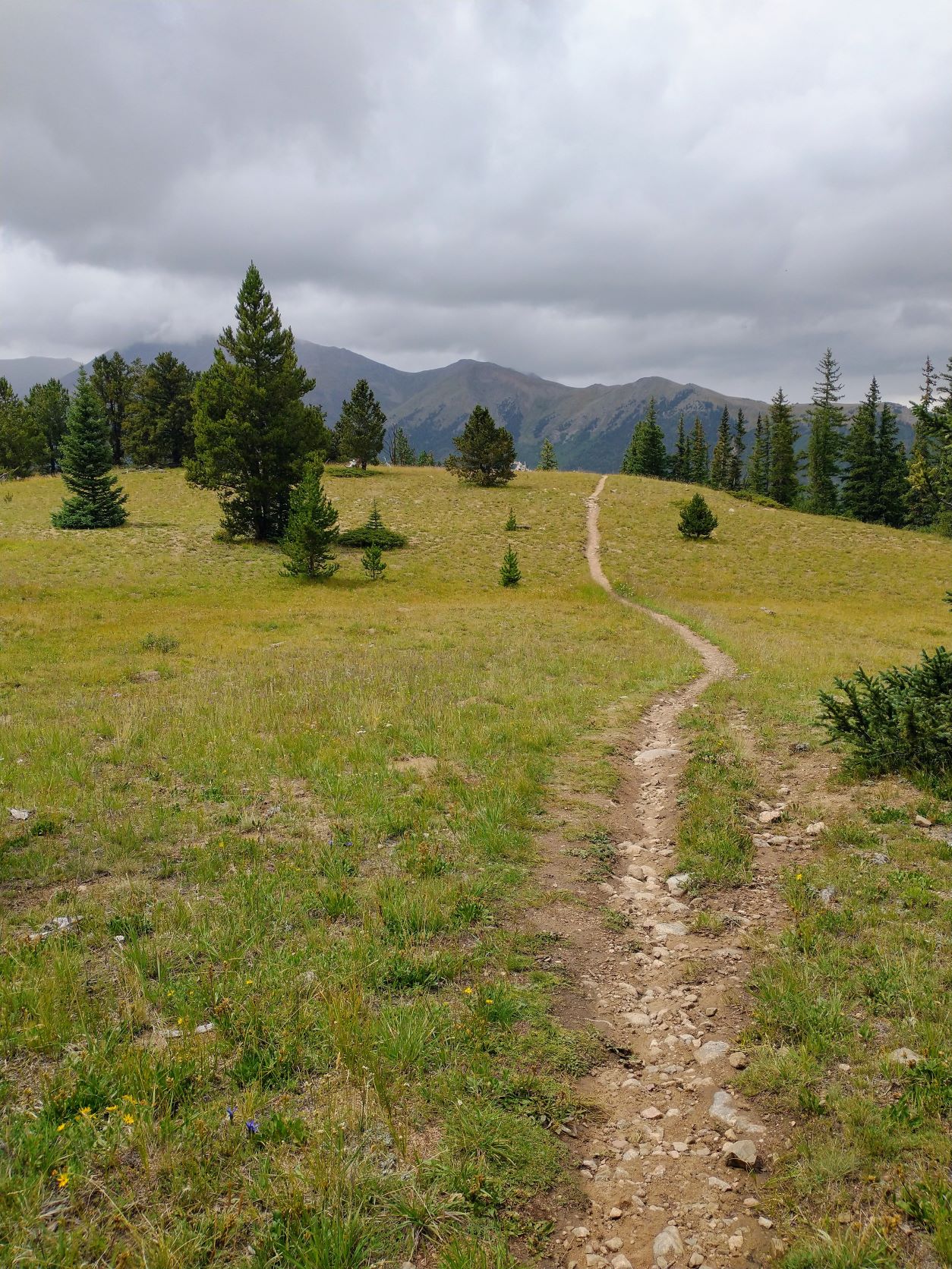

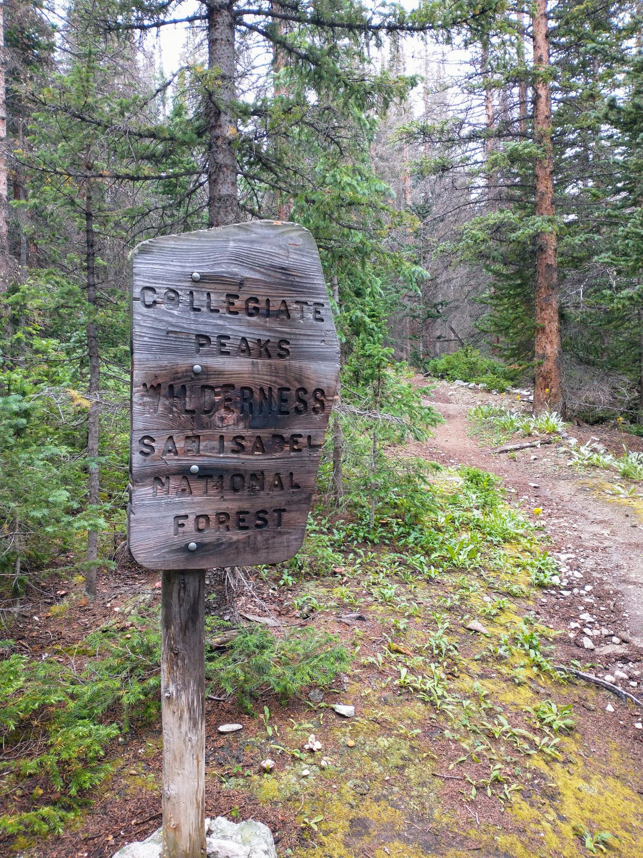
There was a couple of hours of sunshine mid-morning, but otherwise it was cool and damp all day. There were not as many hikers on the trail this day, and no bikers thanks to being in the middle of the official Collegiate Wilderness area.
With all the rain, there were mushrooms everywhere, only a few of which could I identify and only two that I knew for sure were edible. I passed a couple of mountain ponds that might have had beaver in them and spotted some moose tracks and scat, but not much else.
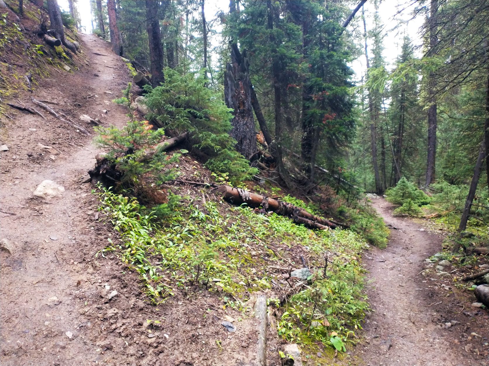
Over the Mt. Harvard ridgeline, a steep downhill and switchbacks brought me to Pine Creek and then my last climb of the day back up near 11,800 ft and a ridgeline that led to Mt Waverly. It wasn’t quite as hard as the previous end-of-the-day hike past Mt. Yale, but the 4-mile descent on the north side down to Clear Creek was incredibly steep and very hard on the legs.
Pretty cool to learn, though, that Clear Creek Valley was formed by the Clear Creek Glacier, one of many that formed in the Sawatch Range during the Pleistocene epoch. It even dammed the Upper Arkansas River at one point and deposited huge moraines of till along the valley’s edge as the last of the Sawatch Glaciers finally retreated 10-20,000 yrs ago.
After I made it to Clear Creek, I found some primitive tentsites hidden under some willows at the Creek’s edge. Just as I was setting up, the rain started back up.
Day Four
Everything was cold and wet again from the previous evening’s rain. Cleaning the muddy splatter off the tent was time-consuming and everything being so damp probably added some weight to my pack. But once I got on trail and moving again, my attitude improved significantly.
The hike up the moraine on north side of Clear Creek was steep, but the switchbacks made it doable. And, the views of the valley and surrounding peaks were stupendous. Once over the top, I had a couple of miles of easy downhill into Lost Canyon, then a couple of miles back uphill to 10k where it plateaued into gentle ups and downs for a couple more miles through more aspen/pine mixed forest. It was very nice and peaceful hiking for a while before finally heading down to the Twin Lakes area and my resupply.
The 800 ft descent to the Twin Lakes was about a mile and a half, so not too steep, and very picturesque. Once I reached the bottom, the trail met up with the CDT and began following the West Collegiate Route. The trail paralleled the south side of the lakes for nearly 4 miles, sometimes close to shore, sometimes higher and farther inland. Mt Elbert, Colorado’s highest peak at 14,440 ft, was only about 5 miles away from me as the crow flies. But clouds and Mt Cosgriff obscured my view.


At the west end of the lakes, the trail turned left to climb up to Hope Pass, but I turned right instead to go 0.75 miles down an abandoned service road to get to Hwy 82 and then into the town of Twin Lakes. I didn’t realize, through that there was no bridge across Lake Creek so I had a very wide and wet crossing to navigate first.
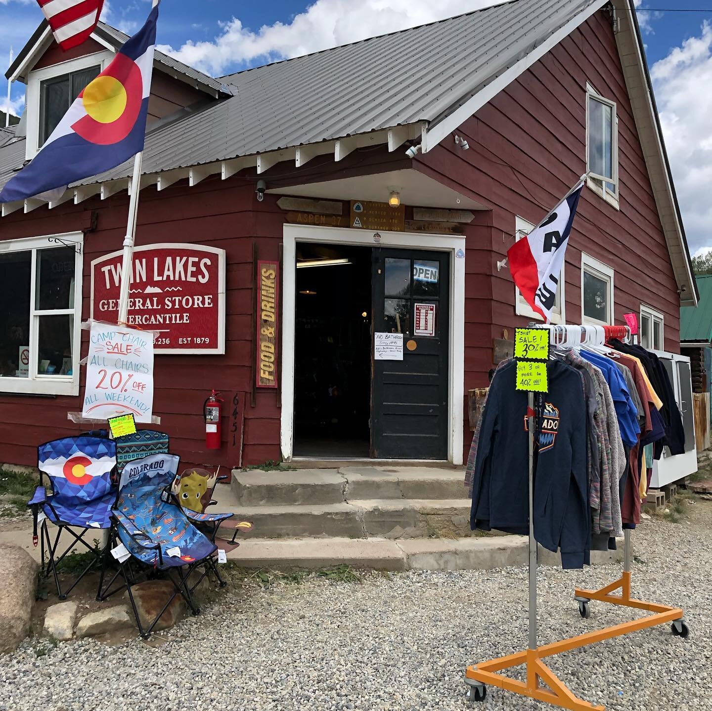
Once I made my way to the highway, I stuck out my thumb and got a ride from a fellow hiker who’d just done a summit earlier in the day. He wished me good luck and dropped me at the Twin Lake General Store, which was where I’d had my supply box mailed the week before. It was very hiker friendly but quite busy, and had only one guy working there. After a bit, he fetched my supply box and showed me where to plug in my phone for a quick charge. I got a burrito, which I nuked for my first hot meal since I started, and a diet coke for lunch. Sitting on metal chairs out front, I went through my box and repacked my backpack while fielding questions from the occasional curious folks entering or exiting the store.
By 3pm the clouds started to threaten again. I asked a local man who was just getting into his truck in front of the store if he was going in my direction. He was and agreed to give me a ride back to the service road. Another wet crossing and short hike back to the trail junction and I was back on the CDT and started my climb up to Hope Pass.
It was very steep and the trail was wet and rooty, but I only had a couple miles to a small forested plateau that had several cleared spots where a tent could be set up. But before I got there, the rain started in again. It was just shy of 5pm but raining too hard to set up camp, so I left my pack under a tree to go get water first. About 500 ft up the trail, I saw more tents and heard the rush of nearby water. Five young hikers, who were huddled under some trees trying to eat dinner without getting soaked, pointed me toward an indistinct trail leading to the creek’s edge. It turned out that all five of them had started their Colorado Trail thru-hike solo, but had met each other on the trail. They were now hiking together all the way to Durango and are now a “tramily.”
~ ~ ~
I was pretty much on schedule for my first 4 days, completing 73.9 miles including a resupply. But I was already feeling the consequences of the very fast pace I’d set for myself. My feet were sore, especially my right big toe, which might lose the nail now I’m afraid. My back hurts, but only at night. Overall, I’d overpacked on food and underpacked on cold-weather gear. My tent was leaking in the rain and my down sleeping bag wasn’t performing well in this dampness.
And now with the uncertain weather forecast continuing, I was about to climb up past the tree line on the CDT for the next few days. I’d be hiking a full thousand feet above anything I’d done on the Eastern Route. I was looking forward to it!