The Great Sand Dunes are a surreal, ever shifting, 5-billion cubic meters of sand trapped at the base of the Sangre de Cristo Mountains. These dunes are the tallest in North America, with Lost Dune now the highest at 742 ft above the surrounding valley and sitting about 8,800 ft above sea level.

Over millions of years, sediments from the surrounding mountains filled the San Luis valley and accumulated in ancient lakes. As the climate changed and the lakes receded, exposed sand was blown toward the Sangre de Cristos, eventually forming the dunefield over tens of thousands of years.
We decided to visit the Dunes after we left Pagosa Springs before heading up toward Twin Lakes to summit Mount Elbert. One of the things we love about vanlife is the ability to be spontaneous and adjust our plans when a novel adventure comes our way. On the down side, it’s hard to make reservations when we don’t really know very far in advance when we might arrive, so we usually don’t.
When we arrived at the Dunes on a Saturday afternoon in mid-September, we discovered that the Park’s lone campground, Piñon Flats, was full for the next few days, and the Park’s dispersed camping was accessible only by high-clearance 4WD vehicles, due to the soft sand and several water crossings. Shoot!


Our best option was to backtrack 16 miles to some BLM property on the high desert that had free dispersed camping… and lots of resident cattle. Then, we’d make the trek back into the Park each day to explore and hike. Not ideal, but it worked.
Mosca Pass Trail – The next day we headed back to the Dunes to hike up into the mountains east of the dunefield. We found a short trail (3.3 miles each way) that paralleled Mosca Creek up to a low pass in the Sangre de Cristos. It passed first through rocky cliff face, then wound through aspen and evergreen forests, and finally meandered through open meadow and wet bog as the creek shrank to a trickle. We didn’t see much wildlife and the mountain flowers and mushrooms were all passed their prime, but it was a beautiful trail and a perfect day for a hike.


High Dune on First Ridge – We saved the dunefield for Monday, hoping that the huge crowds we saw on Saturday and Sunday would be diminished somewhat. There were still plenty of people there, but it was definitely better.
At about 693 feet from base to top, the High Dune on the First Ridge is not the tallest in the park, but it’s still very impressive and in no way an easy hike. According to the Park Service, this is the most common destination for day hikers, providing a great view of the entire dunefield and plenty of steep slopes for sand-sledders and sand-boarders too.
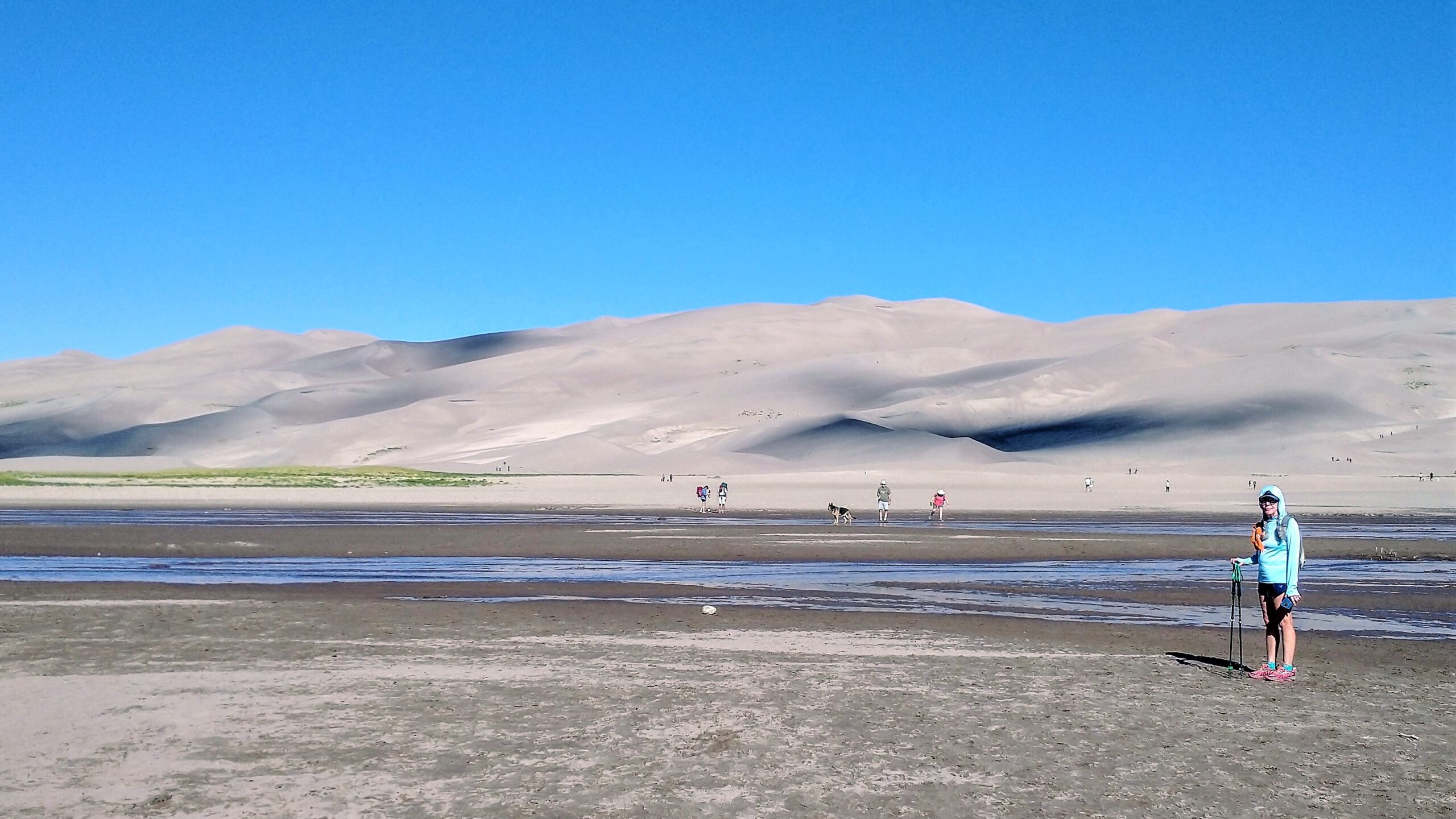


From the Dunes Picnic Area and parking lot, we crossed a half-mile of the Medano Creek bed, then gazed up at the High Dune on the First Ridge. There were no trails, only thousands of footprints scattered among the many smaller dunes and ridgelines below the big one. We made our best guess about the easiest route up and started our climb. The sand was mostly soft and we had to lean hard into our trekking poles. Like many mountains, the higher we climbed, the steeper the slope and the harder it was. We had to stop frequently to catch our breath.


The last bit was especially hard and then danced precariously along a narrow ridge to the summit of the High Dune. At the top, there was a spectacular view of the entire dunefield that stretched massively from Medano Creek to the base of mountains several miles away. It was hard to grasp the scale of it all as one dune melted into the next.
You can get a permit to camp overnight in the dunefield, and on a dark night gaze into the depths of our galaxy. Perhaps on another trip through Colorado.