On our way west through the Oklahoma Panhandle, we decided to stop at Black Mesa State Park and hike to the top of Black Mesa, the highest point in the State. It turned out to be a very nice stopover, not too expensive as state parks go ($14 for the tent sites), with water, showers, flush toilets and a dump station. There was a small store, run by the campground host Carla, who is a school teacher the rest of the year. There was a very friendly and informative park supervisor, Polly, who was all about protecting the Harvester Ants, Horned Lizards, snakes and interesting bird species that called this park home. And, there was a very un-timid group of mule deer that visited our campsite each morning. It’s a good place to stop if you’re passing through.


From the State Park, it was a 15-mile drive to the Black Mesa Preserve and the trailhead. We had a perfect day (not too hot and scattered clouds) to hike the 4.2-mile High Point Trail (8.4 miles round trip). The first couple of miles skirted the north edge of the mesa. Then we had a steep half-mile climb and about a 700-foot elevation change to the top of the mesa. Another 1.5 mile hike along the middle of the mesa top finally brought us to an obelisk, marking Oklahoma’s highest point at 4,973 feet above sea level.


It was a lovely day-hike, but one thing we didn’t realize before is that this mesa is part of a much larger Mesa de Maya, which extends for 45 miles from Colorado through New Mexico and ending in Oklahoma. This was the result of massive lava flows that originated millions of years ago in the Raton-Clayton Volcanic Field located in southern Colorado and northern New Mexico.
Wow! We just stumbled upon a major lesson in geology, plate tectonics, and volcanism! Next stop: Capulin Volcano National Monument to learn more.
The next day, we drove into New Mexico on Hwy 87/64. After passing through Clayton, NM, the landscape began to change dramatically, with buttes, mesas and small mountains dotting the surrounding terrain. With more than 20 miles still to go, Sierra Grande, the largest of the Raton-Clayton volcanos loomed ahead.
We arrived at the Capulin Volcano National Monument shortly after noon and discovered that there was a waiting list for the drive up the side of the volcano to the parking lot at the rim. We quickly signed and perused the visitor center while we waited our turn. It didn’t take long and we were driving up a narrow two-lane road cut into the volcano with a precipitous drop-off and few guard-rails. If you’re scared of heights, close your eyes.


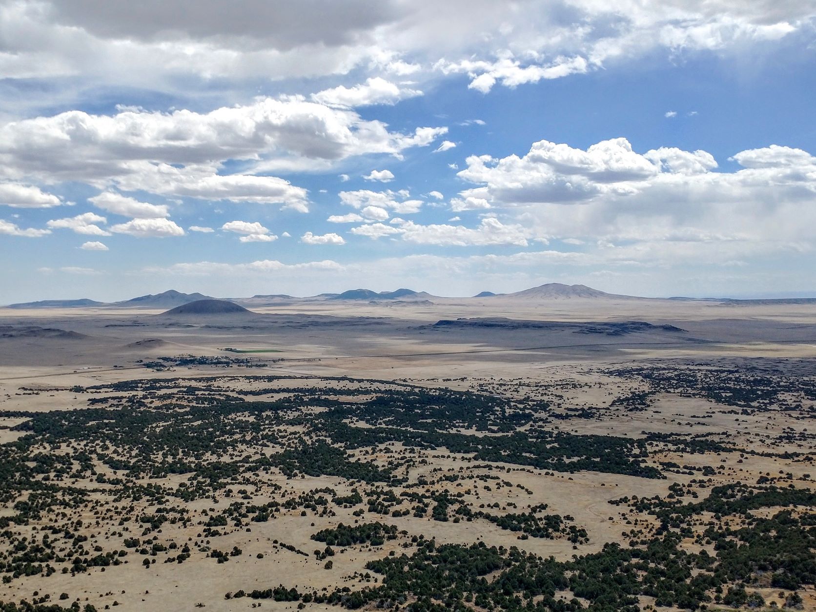
The afternoon had turned very warm and sunny, so we donned our new sun-hoodies, hats and sunscreen before embarking on a 1-mile walk around the rim of this extinct volcano. It was an easy hike around the rim on a paved trail, reaching its highest point at 8,182 feet. Still, the last 300 feet of elevation gain reminded us that we were still getting acclimated, and we took advantage of the many benches along the way to catch our breath and marvel at the views more than a thousand feet below. Dozens of volcanoes, evidence of lava flows, mesas surrounded us on all sides, with the occasional interpretive sign to tell us what we were seeing.


When we finished with the Crater Rim Trail, we descended 105 feet to the bottom of the crater and the plugged vent of the extinct Capulin. Then, after driving back down the cone, we hiked the Boca Trail on the volcano’s western face to check out multiple collapsed lava tubes, lava flows and a spatter hill along the way.
We finally exited the park just before their official closing time of 5 pm, satisfied that we’d personally made the connection between Black Mesa Preserve and an ancient volcanic field. Pretty cool!
One thought on “Black Mesa, OK to Capulin Volcano, NM”