
The Buffalo River flows for 153 miles through some of the most scenic areas of Arkansas’ Ozark Mountains. The lower 135 miles of the river were protected in 1972 by an Act of Congress and designated as the nation’s first National River. It’s administered by the National Park System and is protected from industrial use, damming, and rerouting of any kind, thus also protecting the environment around the river, its vegetation and wildlife.
The Buffalo River, with its easy whitewater rapids, long run, and multiple launch-points, attracts lots of canoers and kayakers. The Park Service even allows boaters to camp on exposed gravel bars. In addition to recreating on the water, the Buffalo River Trail (BRT) follows the southern edge of the river. With the promise of scenic bluffs, ridgelines and cascading creeks through the highlands of the Ozark wilderness, the BRT lured us to its banks in late April for a hopefully spectacular hiking experience.
It is a work in progress, however, with just three sections completed: the Western Section, the Eastern Section, and the Maumee Section. We decided on hiking the westernmost 36 mile section from Pruitt to Boxley Valley… and back.


Unfortunately, there had been a great deal of rain during the previous three weeks, and flooding conditions were widespread. And there was more rain in the forecast, so we adjusted our plans to hike the trail in shorter sections in-and-out, with only a single overnight tenting on the trail, but otherwise sleeping in the van and leapfrogging forward every couple of days.
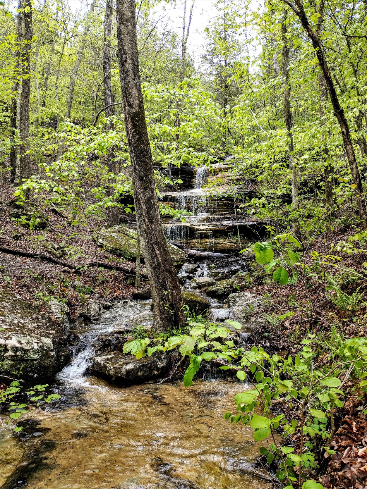
The first part of the hike at the Pruitt end was absolutely gorgeous. The forest was teeming with wildflowers and birds. Our favorite forest singer, the wood thrush, serenaded us each day. Luckily, we had decent weather for the first three days and great trailheads and campgrounds along the river to park our van.


Then an approaching storm system pinned us down in our van for a day at Kyle’s Landing Campground. It was torrential with high winds and non-stop lightening all night and hallway through the next day. The water level on the Buffalo River leaped at least 5 feet overnight and was still climbing. The tributaries were likewise racing and deep.
After a break in the storms, we continued toward Boxley Valley and the hiking became more strenuous and mountainous, along steep bluff lines with spectacular views of the river. All of the tributaries were full, so we had several fast-water crossings. Our feet were wet all day long. But at the end of the day, we were rewarded with a beautiful meadow campsite beneath a full moon, which felt like our own private oasis.


The next day, we hiked back to Kyle’s Landing, noting along the way that the Buffalo River had gone down just a bit and the water crossings were just a little easier. Back at our van, we were able to clean up and dry out some.
However, it stormed again overnight. We drove to the last trailhead at Boxley Valley to hike 12 miles in-and-out on the last 6 miles of this section and complete our hike. But the flood levels were now truly scary, there was more rain in the forecast for the day and the first water crossing looked unpassable. We abandoned the rest of our trip, hiking 60 miles instead of the planned 72 miles. But that means we have a pretty sweet 12 mile section on the BRT to complete when we come back again next year. And hopefully a 4-day paddling trip, too!
I loved reading about your latest adventure / hike. Looking forward to the next one!
I so enjoy your reflections and photos! The river crossing photos are my very favorite! Such an adventure! And since I’ve never explored the Ozarks, this is tremendous inspiration to me to visit the area and hike at least some of the trails!
We highly recommend it. The Ouachita Trail is nice too, though parts of it were seriously overgrown last year. We haven’t done the Ozark Highland Trail, but it’s on our list.